Sitemap

June 3, 2004 - Blanchard Mountain
Elevation Gain: 1400 ft
Time (RT): ~3.5 hours
Distance (RT): ~9 miles
Difficulty: Easy/Moderate
  • Blanchard Mountain @ NWEA (w/good map)
  • Blanchard Mountain @ Seattle P-I

    Related Book:
    Winter Hikes in Puget Sound & The Olympic Foothills

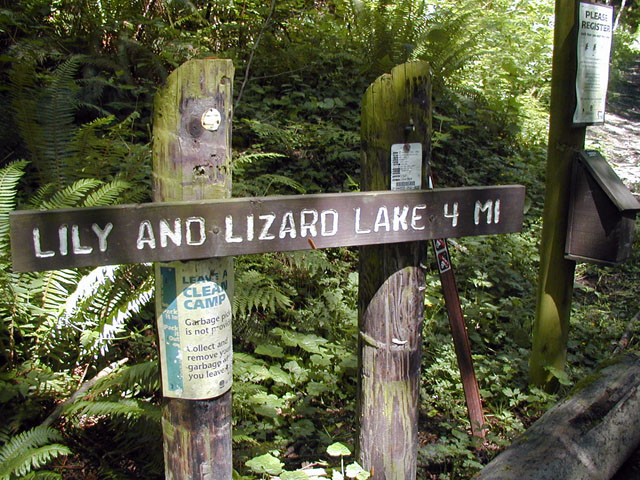
  • From Seattle, drive north on Interstate 5 and take Alger Exit (240). Turn left over the overpass, drive a half-mile to Barrel Springs Road and turn left. After 1 mile find a wide gravel road on the right marked Blanchard Hill Trails. Drive 1.6 miles to pass the lower trailhead, continue another 1.6 miles to reach the upper Lily/Lizard Lakes trailhead. There is a large parking area 0.1 mile past the trailhead.
    blanchard01.jpg
    The Upper Lily and Lizard Lakes Trailhead
    640x480
    blanchard02.jpg
    Walking through the forest
    480x640
    blanchard03.jpg
    Lizard Lake seemed more like a swamp
    640x480
    blanchard04.jpg
    "False" Lily Lake
    640x480
    blanchard05.jpg
    Lily Lake from a bench on the shore
    640x480
    blanchard06.jpg
    Arriving at the North Butte, looking to Oyster Dome and Samish Bay
    640x480
    blanchard07.jpg
    Blanchard Mountain's North Butte
    640x480
    blanchard08.jpg
    Oyster Dome and the San Juan Islands
    640x480
    blanchard09.jpg
    Looking north to Mt. Baker
    640x480

    All photos Copyright © Chris Duval